Celebrating 3+ years on the web and passed 150,000 page views in May 2004
This is a page from our Subscribers Edition. Our free site remains free. How to subscribe to our separate online magazine

Skagit River Journal

of History & Folklore
Subscribers Edition Stories & Photos
(Seattle & Northern 1890)
Covers from British Columbia to Puget sound. Counties covered:
Skagit, Whatcom, Island, San Juan. An evolving history dedicated
to the principle of committing random acts of historical kindness


Noel V. Bourasaw, editor 810 Central Ave., Sedro-Woolley, Washington, 98284
Home of the Tarheel Stomp Mortimer Cook slept here & named the town Bug

(Click to send email)

Poets on the Peaks by John Suiter

Part One: Gary Snyder on Crater Mountain, 1952
By Noel V. Bourasaw, Skagit River Journal
(Snyder on Crater)
Gary Snyder at Crater Mountain lookout, 1952

      John Suiter's beautiful book, Poets on the Peaks, tells the story of how three Beat Generation poets, Gary Snyder, Philip Whalen and Jack Kerouac, worked as firewatchers at lookout stations in the North Cascades in the summers of 1952-56. Kerouac is certainly the most widely known of the three but Snyder and Whalen spent the most time here and interacted with the mountain peaks more often and their poetry was more arguably influenced by the mountains. This book was published in 2002 and our story will be in two parts. Part One is about Gary Snyder and the mountains themselves. Part Two introduces the two other writer-firewatchers and their place in the Beat Generation of the 1950s.
      I was in junior high in 1958 when my late older brother Jerry came home from Western Washington State College and introduced me to a two-deck solitaire card game about basketball that he said he had heard about in connection with Kerouac. I never learned how he discovered the game, since it first appeared in print many years later in Kerouac's book, Desolation Angels, but I was fascinated both by it and Kerouac from that moment on. That was two years after Kerouac's summer 1956 stint on Desolation Peak on the east side of Ross Lake. I suppose he heard about it while bumming about in San Francisco, the seat of Beat activity. We played the game for three decades after that, a two-dimensional precursor of sports video games and of my own chase after Kerouac's ghost after his death in 1969.
      Snyder was the lynchpin of the trio, with childhood connections both to logging and the Cascades and being the first to serve as a lookout. For the last 50 years he has traveled a triangle with the Cascades at the far north end, San Francisco and the old California gold country at the south and Japan at a point to the west. Suiter begins the book by laying out the story of how Snyder was born in 1930 in San Francisco where his parents were desperately seeking work after a bleak time in their native Washington state after the 1929 stock market crash. They soon returned to Seattle and eventually lived on a dairy farm north of town, where he could see Mount Baker in the distance even further north. At age 10, Gary accompanied his father when he logged in the woods, a common second job for farmers, and Harold Snyder put him on a crosscut saw, giving him the classic instruction, "don't ride the saw — don't push, only pull." Gary's love affair with the woods began and has never ended.
      After his parents divorced, Gary moved with his mother and sister to Portland but came back up to a YMCA camp every summer at old Spirit Lake on Mount Saint Helens. A special category was created for poorer kids and he soon learned trail tasks that came to him naturally. He earned a scholarship to Reed College in Portland from 1947-51, but he returned to the Gifford Pinchot Forest around Mount St. Helens starting at age 19, this time as a logger. He earned money in the summer by packing food for lookouts and then graduated to bucking logs.

(Granite Creek guard station)
Granite Creek guard station after Frank Beebe's family expanded it

      He graduated in the spring of 1951 and logged at Oregon's Warm Springs Indian Reservation that summer where he was inspired to write "A Berry Feast," the poem that made him famous. San Francisco poet Lawrence Ferlinghetti later joked that Snyder's poem was the signature work of "The Bearshit-on-the-Trail School of Poetry." The poem was about a "first fruits" ceremony, one of the rituals that he became fascinated with in 1949 while studying Tsimshian Indians of British Columbia. His senior thesis about the Swan Maiden myth of the BC Haida tribe is often described as the most-copied Reed thesis of those days. Suiter's detailed notations include background information from both texts and communications with individuals.
      The University of Indiana awarded him a scholarship that spring and Snyder seemed a natural for the noted school of anthropology there. But first he went to San Francisco, which he considered to be the only real city on the West Coast. The seeds were soon planted for his career as a writer and for his lifelong interest in Buddhism. Philip Whalen, his friend and roommate from Reed joined him in the city late that summer and one night after dinner they wandered into one of the few bookstores in the country that offered a wide selection of Asian books at that time. Snyder's life was forever changed when he bought David Suzuki's Manual of Zen Buddhism.

Gary Snyder heads toward Crater Mountain in 1952
      Suiter begins his book with Snyder's arrival on the upper Skagit river in June 1952. The fall before, he hitchhiked back to Indiana University and somewhere on the backroads of Nevada he began reading Suzuki's book, which introduced him to koan paradoxes and the Sutras of Zen Buddhism. Although he was quite a good student at the university, he decided during the second semester that his destiny lay in Japan. He applied for the U.S. Forest Service [hereafter USFS] position in the Cascades while still in school and in March he dropped out and hitched a ride back to San Francisco. His youthful bravado led him to volunteer for the "highest, most remote and most difficult of access lookout" in the North Cascades.
      After the Forestry crew recovered from a major laughing attack, Blackie Burns, the assistant ranger assigned him to the lookout [LO] on 8,129-foot Crater Mountain, the highest manned peak at that time. He arrived at Marblemount in the last week of June and found bunkhouses built by the CCC in the early 1930s, a cookhouse, office, fire school classroom, a long stable and corral, and open pasture for the pack mules and saddle horses that transported firewatchers and their supplies to various LOs.
      He found an all-male milieu at Marblemount, even though the first firewatcher in 1902 was Mabel Gray in the Clearwater river area of Idaho. Martha Hardy published a book in 1943, Tatoosh, about her firewatching days, and Bonnie St. Aubin manned the Crater lookout with her husband in 1951. Gerry Cook, a Desolation Peak firewatcher starting in 1970, told Suiter that although the Forest Service was a macho outfit, the firewatchers were always different. Snyder quickly made friends with Burns, the crusty old veteran who was the de facto chief at Marblemount, and the other young men who were about to ascend the peaks. They were a cross-section of experienced woodsmen, schoolteachers working for the summer and loners who loved the woods but did not hold full-time jobs on the outside. Women became firewatchers again in the mid-1950s as the late Maxine Meyers and others took positions. For that story see this website:
      Since Crater was still snowed in, Snyder was assigned to trail work at the Guard Station at Granite creek. He traveled with a pack team up the gravel road that wound through and past Newhalem, the town created by Seattle City Light when a series of dams were built, starting in 1918 with the Gorge dam. The Skagit Gorge started there, a narrow stretch of the river that was strewn with huge boulders and that marked the end of navigation back in the 1880s when gold miners headed up to the diggings at Ruby creek. The gravel road stopped abruptly at Diablo dam, which was built in 1929. The whole pack train was transported up over Ross dam by an incline hoist that was erected during construction of the dam. They crossed Lake Diablo by tugboat to the foot of Ross Dam, the newest — built in three stages from 1940-49 — where Gary learned about the next leg of the trip. A sky-hook crane lifted a wooden platform 540 feet up the face of dam, carrying the entire combination of Snyder, the packers, their horses, mules and supplies over to the recently created lake that stretched behind Ross to the area of the Canadian border. From there the party continued another day through the woods of Ruby mountain.
      Their destination was one of the more historic structures of the upper Skagit. Back in the late 1870s a party of upriver settlers that included Karl von Pressentin, Otto Klement, Jack Rowley and John Sutter followed the same route in pursuit of placer gold that Indians had discovered. Rowley told the Bellingham Bay Mail newspaper [later named the Puget Sound Mail in LaConner] on April 19, 1879, that he was led to his first strike on Ruby creek by a "God-like hidden hand." Sutter named Ruby creek when he mistook garnet stones in the streambed for rubies. By July 4, 1980, nearly 2,000 miners worked their claims in the area. Some came up the Skagit on a harrowing ride during a year of abnormally deep water. They then packed in along the precipitous gorge along a series of rope ladders and switchback trails including the aptly named Goat Trail that clung onto the steep ledges of the canyon. Even more packed down from British Columbia on an old Indian trail along the east bank of the Skagit. Although the rush played out within a year, argonauts continued arriving through the turn of the twentieth century. Suiter tells how in 1902 three shipwrights from the Seattle waterfront built a solid cedar log cabin on banks of Granite creek. The cabin was built soundly to last a hundred years but they were gone in two. Another young miner from Ohio named Frank Beebe had worked a claim nearby in 1895 and he returned in 1920. He camped in the abandoned cabin, which he soon claimed and moved, log by log, down to Canyon creek near where it joined Granite. The creek ran just ten yards outside the front door and he soon built a hand-roped log footbridge over it to a barn he erected for his livestock. Later that decade he moved his wife and young daughter down to the cabin and they added on a kitchen and sleeping room onto the rear. In 1928 the Forestry Service hired him. Later, when he returned to Bellingham, the USFS bought it and used it for a guard station. That station was a temporary destination for Snyder and two other firewatchers for three weeks in 1952.

(Book cover)
Sourdough lookout

      Granite creek rises 15 miles south in Rainy Pass, the route of the present Highway 20, which opened in 1972 to cross the North Cascades to Winthrop. Canyon creek rises deep in the heart of the Pasayten Wilderness near the Pacific crest, 12 miles northeast from the guard station at Holman Pass. Most of the Ruby creek diggings had been covered by water that begin rising behind Ross dam in 1949. By the summer of 1952 the lake rose to its highest level. The cabin there on Canyon creek was home for Snyder and two other firewatchers for three weeks in early July 1952 as they cleared trails, inventoried supplies and repaired phone wires On July 19, another grizzled old packer, one-eyed Andy Wilcox, arrived at Granite creek and prepared for Snyder's last leg up to Crater mountain. Snyder later described Wilcox in his journal as a dead ringer for Gabby Hayes and Slim Pickens who could chew Copenhagen snoose in one cheek and huckleberries in the opposite and never mix them up. The intellectual Snyder was respected for his trail work but he made an impression on the others as a bit of an odd duck as he loaded up his personal supplies that included a huge sack of brown rice and a gallon of soy sauce. As they departed, Wilcox remarked: Wilcox "Shit Snyder, you getting just like a damned Chinaman." Young Tommy Buller, then just 18 and a descendant of upper Skagit pioneers, recalled years later that Snyder sat cross-legged and was planning to go into a Buddhist monastery: ". . . me, I'm about 18 and I see all this, and I said, 'Is that boy in this world or some other world?"

Snyder ascends Crater mountain
      At first light the next morning, Gary and two other firewatchers set out on foot, with Wilcox behind them bringing up the mules. They followed the steep trail above Canyon creek that climbed gradually on switchbacks up the densely wooded south flank of Crater mountain to Crater Lake and then wriggled up the southwest shoulder of the mountain to the 7,000 foot level where they found the last patch of level ground. After 500 more feet of elevation, the terrain became too difficult for the mules. Nearby was a ledge of basalt that served as a natural platform for off-loading the mules. A wooden pallet stood there with turnbuckles for securing a load. Wilcox explained that all his six weeks of supplies had to be hand-hosted to the next level. On the way up, Snyder saw eyebolts drilled into the rocks, with fixed ropes to haul up the side of the cliff. Faded yellow paint blazes showed the way up through the mist. He was amazed to realize that the LO itself had been built by teams from the Civilian Conservation Corps [CCC] and Forest Service who hauled all the lumber and parts up this same way.
      The Crater LO was the highest such structure in the mountain range in 1952. Nine LOs were previously built at higher elevations but all of them were in ruins by then. As it turned out, Snyder would be the last firewatcher on this elevation of Crater Mountain. Crater actually has two peaks a half mile apart, which are connected by a narrow saddle. The LO peak on the west was at altitude 8,129 feet while the eastern peak rose to 7,500 feet. On a clear day, Snyder would be able to see 3 million acres of forest, but in his first few days his perch was socked in, his supplies stayed under a tarp 600 feet below, he slept fully clothed and his fingers were too numb to write. It wasn't long until he understood why the rangers were so amused when he specifically asked for this remote outpost.
      But Snyder was equipped both physically and mentally. He had been climbing peaks in both Oregon and Washington for more than eight years. He climbed his first mountain as the atoms bombs were dropped on Hiroshima and Nagasaki in the summer of 1945 when he was just 15. He soon climbed Mount Hood. In 1946 he joined the Youngstigers (German for climber) of the Portland Mazamas mountain club in 1946 and like the others, he believed in climbing each mountain more than once to learn it well — 14 times on Mount Hood alone.

The Osborne fire finder
      Once the weather cleared in late July 1952, after seven days of fog and visibility near zero, Snyder hiked down and brought his supplies up in several trips. There was no plumbing or running water in the LO so he had already learned to collect snow in big pans where it slowly melted for cooking and cleaning. The first job of every firewatcher was to learn every peak, ridge, creek and false smoke in the peaks and valleys and passes around him. The tool provided was an ingenious device called the Osborne fire finder, a stationary disc map with a rotating peep sight for pinpointing smoke in case a fire should erupt. It was mounted on a steel shaft driven through the center of the cabin floor and plumbed into bedrock, and it was calibrated on the North Star. Suiter describes it as one of greatest tools ever devised for learning terrain, invented by "Bush" Osborne, an early regional Forestry Service chief from Portland. A map on the disk charted an area 22 miles out in every direction, covering 1,500 square miles. In the rare case that a fire was spotted, additional readings from a second or third lookout could triangulate the position of the smoke.
      Suiter's research revealed that in many ways, LOs were originally mere housings for the fire finder device. The first LOs in the teen years were merely seasonal sites for the fire finder, a tent for watchers and a phone nailed to a nearby tree and miles of phone wire. They were then called "rag houses." In 1929 the rag house on Crater dud not even have a phone. If the firewatcher spotted smoke, he took a reading with the Osborne, then hiked 7 1/2 miles down to Beebe's cabin to phone in his report to the fire office 25 miles away in Marblemount.
      The sudden solitude might have been oppressive to other men, but Snyder thought it to be delicious, the dense fog of the early days through the windows all around reminded Snyder of a shoji screen in a Japanese tea hut. Soon after tidying up the LO and stowing away his supplies, he began practicing the calligraphy that he was learning that year and he named his peak "Crater Shan," the Chinese appellation for a peak, soon using it as his return address on letters to his friends. He noted in his journal that the LO was a perfect Zen hermitage, and he felt right at home with his basic Zen texts for reading, his collection of teas — green Japanese tea and lapsong souchong, and his collection of sumi brushes for Chinese calligraphy. While some firewatchers soon became bored, Snyder kept up a steady regimen of meditation, calligraphy, reading and zazen, the Japanese style of sitting cross-legged for long periods of time in preparation for the trip to Japan he was planning to take very soon. Outside he strung Tibetan prayer flags on the guy wires connecting the cabin for radio communication and he found a nearby precipice overlooking Jerry Glacier for zazen sitting outside as the weather cleared up. In Part Two we will share Suiter's story of how all three of the poet firewatchers were affected by Zen Buddhism.

The mountains in Snyder's vista and Henry Custer's 1959 Skagit exploration

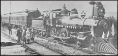
"The river flows here between rocky banks, with a swiftness and impetuosity which even makes my expert Indian canoe men feel more or less uncomfortable. From the anxious looks they cast around, I conclude that it is about time to look out for a secure harbor for our canoe. We had stopped our onward course not a moment too soon; for within a distance of only 100 yards from our harbor, we found the River forming a perpendicular fall, which . . . if we had dashed over it, would have engulfed the whole party & sent us inevitably to our last accounts." — Henry Custer, August 1859.

      Once the days cleared up, he got to know the nearby peaks very well, especially Jack Mountain, three miles to the north. One of the most marvelous aspects of Suiter's book is his distillation of the research of the earliest recorded history of the mountain range. He read the Report of Reconnaissances, published in 1866 from Henry Custer's journal of his August 1859 expedition down the Skagit from British Canada with Indian guides. If you want to learn what the upper Skagit was like when it was still literally untouched, you should read Custer, who was a topographer for the Northwest Boundary Commission, which surveyed the border between British possessions and the United States in 1857. In 1858 a fellow member of the commission, George Gibbs, attempted to explore the Skagit from the mouth of the river, portaging around the log jams at future Mount Vernon, but was unable to continue past the Skagit Gorge. That was the year of the short-lived but intense gold rush to the Fraser river in British Columbia, and Gibbs went up the Skagit with miners who were camped out on the shore of Bellingham Bay. In July 1859, Custer was assigned to explore south on a Hudson Bay brigade trail around what he called Chiloweyuk-lake, now Chilliwack Lake in British Columbia. On July 25 he was sent east towards the Skagit river. In the first week of August he saw Mount Hozomeen, a twin-peak mountain just south of the border on the east bank of the river. His party floated down Little Beaver creek to its mouth on the west side of the river, then crossed over to the Hozomeen area and on August 25 they descended down the Skagit to Ruby creek. Custer came to depend on a Canadian Indian elder named Chinsoloc who turned out to be quite a cartographer. He was the one who recounted the name of Hozomeen and he named what is now Jack Mountain, Nokomokeen. After Jack Rowley's 1879 strike on Ruby creek near the mountain, settlers and miners renamed the mountain for him. For more information about Custer, see Gretchen Luxembourg's fine National Park Service history website:
      Suiter writes that Custer called Little Beaver "Glacier Creek" because of its origin in the Challenger Glacier. Native guides called it "Wila-Kin-ghaist." The valley along the creek was formed 10,000 years before, when what was left of the Cordilleran ice sheet was an array of crevassed glaciers east of side of Whatcom Peak and continuing north into British Columbia.
      As Snyder looked around his 180 degrees, he saw no roads, towns, clear cuts or dams, but instead the same sights that Custer's party would have seen nearly 100 years previous. Two of the peaks he saw, Crater and Jack mountains, are ancient volcanic rock thrust up from the complex faults of the bedrock below later Skagit river and Ross Lake. From the late 19th century on, this area along the river became known as the Ripraps. Jack is 1,000 feet higher than Crater and in Gary's view it blocked much of Big Beaver and Little Beaver creeks across the lake. Due north are Hozomeen and peaks of the Hope range in British Columbia. Through his east window he looked down the Crater mountain saddle to the east peak, then Hart's Pass, "blue heaped upon blue" in the old Zen phrase. He looked south along a dozen peaks to the drainage of Granite Creek, stretching back to Rainy Pass.
      As Snyder looked west, he saw peaks that were named in the first half of the century by mountaineers: Fury, Challenger, Terror, The Barrier, The Chopping Block, Despair, Triumph. Those were the Pickets, 20 summits at 7,500 feet or more in a 7-mile range, the wildest and least discovered. Suiter, an accomplished climber himself, notes that the Pickets were a climber's Eden in the early 1950s, many peaks of nameless rock and ice still not climbed even then. Lage Wernstedt, who climbed scores of mountains during his cartographic work for the Forest Service in the 1920s, named the Pickets. Suiter learned that the first alpine ascent of a summit in the Pickets occurred 20 years previous when William Degenhardt and Herbert Strandberg climbed the Chopping Block, and that Fred and Helmy Beckey ushered in the modern era of North Cascades mountain climbing beginning in the late 1930s. Early miners gave other peaks in Gary's view hard luck names such as Three Fools Peak, Freezout Mountain, Devil's Dome, Hell's Basin, Grizzly Creek, Cutthroat Peak, Deception Pass, and Last Chance Point. Suiter writes that in an aesthetic attempt to blend natural beauty, Snyder tacked up a nude photo of an old girlfriend from Portland, her nipple just poking Mt. Challenger, and Mt. Sourdough by her thigh.
      One of Suiter's most outstanding offerings is his detailed story of how the U.S. government administered the vast wilderness and mountains of the North Cascades. The story is much too complicated to summarize here but we note that the USFS was established in 1905 in the Department of Agriculture, and the National Park Service in 1916 in the Department of Interior. "From that time on, the question of which agency would administer the wilderness, and to what end, would be a theme running through the history of the North Cascades." Some officials in the USFS, such as Robert Marshall and Aldo Leonard — who became famous for his saying "Think like a mountain," envisioned designation of "primitive areas" that would remain forever roadless and unlogged. In the late 1930s, Robert Marshall and USFS director Ferdinand Silcox recommended establishing a huge Glacier Peak Wilderness Area, but they died within months of each other in 1939 and their proposal died with them. The USFS later created a classification called a "limited area," which prompted an anonymous wag to say that the category meant "we haven't figured out yet just where to put the logging roads."
      When Snyder was on Crater, the mountain was still safe away from logging in the North Cascades Primitive Area, 15 miles from the nearest roadhead, and he believed the USFS to be a quiet, conservative agency that was taking care of public lands. Later he insisted that those were "the last years of righteous forest management in the United States." Much later, in 1968, the North Cascades National Park was established, transferring 700,000 acres of the Mount Baker National Forest from the USFS to the Department of the Interior after many years of effort by conservationists. When I was a boy, there was much talk of the proposed North Cross-State Highway, originally funded by the state of Washington in 1895, and promoted by Sedro-Woolley businessmen David G. McIntyre, Sig Berglund and Vern Sims, among many others. That highway finally opened in the summer of 1972, through Rainy Pass rather than through Cascade Pass to the south as was originally envisioned. It is one of the few major roads anywhere that stretches nearly 100 miles without a billboard. Highway 20, as it is now known, is still a traveler's delight, free of commercial blight. For bicyclists and motorcyclists who really experience the great outdoors rather than being cooped up in boxes — cars, trucks and campers, Hwy 20 is a Mecca of sorts during the months it is open, usually March through October.

Who lived here before and when we learned about them
      Another of the strongest points of Suiter's book is his detailed look at the pre-history of the North Cascades. He spent a lot of time here, climbing peaks, interviewing key characters of the story who still live all over the country, and studying the available documents. Two of his sources are people who have provided much detailed information for own research of Skagit river history: Ryan Booth, a ranger with the National Park Service out of Sedro-Woolley, and Jesse Kennedy, cultural resource specialist at the Marblemount Curation Facility of the North Cascades National Park. Kennedy and his staff have carefully catalogued more than two million documents and objects that have been collected for nearly a century but languished for decades in drawers, collecting dust. By the time Suiter began researching his book in the late 1990s, the artifacts were being sorted and tagged and they are now stored in special humidity-controlled rooms that are accessible to those who want to research. It is not a museum, however; it is not open to tours by the general public. The ranger station does have a visitors center nearby where visitors and hikers can get their bearings.
      Suiter discovered that the pre-history of the North Cascades was as unknown to Snyder in 1952 as it was to Henry Custer in 1859. Custer and his Indian guides remarked that there were few signs of Indian encampments along the river and that the hunting trails looked grown over and unused. Anthropologist Robert R. Mierendorf addressed this and other misconceptions in a detailed 1998 study of the mountain range. He noted that the apparent absence of Indians could well have been the result of two factors: catastrophic floods, such as the 500-year-event in the early 19th century, that would have destroyed Indian settlements, and disastrous outbreaks of smallpox that spread before European settlers as early as 1770. Another one during early settlement days in 1890 that killed hundreds of natives up and down the river. Later archeology showed travel through there for thousands of years. In a 1999 email, Robert R. Mierendorf told Suiter that early explorers found stone tools and weapons on Sourdough and he noted that sites along the travel route of the upper Skagit river valley revealed very small artifacts of flaked Hozomeen chert.
      Even by 1952 there was very little knowledge of the prehistoric people of Skagit, because most historians assumed that the Cascades and especially the Skagit gorge near Newhalem formed a natural barrier between coastal and interior cultures. Many people thought even that late that the only travel by natives through the passes was for trade. Those assumptions were based on what was then called the Boasian model, which Snyder learned in anthropology courses at Indiana. This view was largely unchallenged until the 1970s when the first professional archeological survey of the Upper Skagit was conducted in 1971. Suiter notes that the first firm evidence of ancient human activity in the area was discovered in 1975. Even by 1986, only 15 archeological sites behind Ross dam were located, but by 2002, when he published the book, more than 150 known. We now know that ancient hunters roasted elk and deer under rock shelters at many spots along the river. Mierendorf: discovered that memories of native elders had been ignored when they told of ancestors living in high elevation areas, at least seasonally, where they gathered berries, hunted and practiced traditional ceremonies. In an email just before publication, Mierendorf told Suiter that Indians probably lived and/or traveled on Ruby creek as early as 8,000 years ago, "but I have no proof yet." Snyder wrote a poem that year — "History Must Have a Start," in which he bemoaned the lack of knowledge about native history, and in a later article he wrote, "I hope that time will come when we who love in the foothills will start our story with the Nisenan as our previous teachers and spiritual ancestors, rather than the brief era of the gold miners." But falling back on his studies, he told Jack Kerouac in 1956 that "I don't think the Skagit Indians ever penetrated that far back into the mountains."
      Suiter also shares his research about the discoveries of chert quarries on Mount Hozomeen in the 1980s. If Custer had asked old Chinsoloc, his Indian cartographer, he would have discovered that native people were drawn to Hozomeen for thousands of years by metamorphic chert. According to Suiter, chert is a rock that chips to a good cutting edge and rivals obsidian as material for arrowheads, spear points, axes and knives. Research over the past 20 years shows that the ancient natives quarried Hozomeen chert on the Upper Skagit and supplied blades to a widespread region from Puget sound to the Similkameen valley, and from the Fraser river South to Lake Chelan. One of the largest chert quarries was on the western flanks of Desolation Peak when Kerouac served as firewatcher in 1956, but no one knew at that time.

(John Suiter)
John Suiter on Mt. Monadnock, Vermont, 2002

      As his stint continued into August, Snyder was still fascinated with his environment and incorporated his observations into his writing and study. He wrote in his diary that although some might assume that the scene was static, the changes in light were the thing to watch every day. "I became aware of how the energies of mist, white water, rock formation, air swirls — a chaotic universe where everything is in place — are so much part of the East Asian painter's world." He was thrilled to see the Northern Lights high over British Columbia that month. At night he immersed himself into Suzuki's manual and learned more about the Diamond Sutra, a masterpiece of paradox that the Buddha named Vajracchedika. It was also called the Diamond Cutter, focusing on a diamond's incisive properties versus its clarity or preciousness as gem. Suzuki also wrote about the intellect's ordinary dualistic groove.
      Late in the third week of August, two other firewatchers visited Snyder, the first people he had seen since two boy scouts a few weeks before. Jack Francis told Suiter that he remembered finding Snyder sitting in the LO doorway clad only in a jockstrap and Japanese sandals, his hide brown from the sun, and prayer flags rippling along the guy wires. His guests told him that they were packing out the next day because the fire risk season was ending as snow began falling. They brought him his first mail, including two letters from Phil Whalen, who told him that he wanted a mountain of his own. A few days later, Blackie Burns's voice crackled over the radio, telling him to close up the LO. Within hours, Snyder lowered the storm shutters, stowed the equipment and leaped down the trail to Granite creek, saying goodbye to the pikas and chipmunks on the trail. Just 100 yards down, the LO disappeared completely.


      Part Two of the story will be shared first with our paid subscribers in the Fall of 2004 in the Skagit River Journal online magazine. Read about how to subscribe. Also see our original story of The Firewatchers of the North Cascades, which is timely reading as the high country warms up. Sources for our story include: Poets on the Peaks, publisher Counterpoint Books, 2002; Ann Charters, Kerouac a biography, New York: St. Martin's , 1973; Steven Watson, The Birth of the Beat Generation; and two Jack Kerouac books: The Dharma Bums, 1958, and Desolation Angels, 1965.

Please report any broken links or files that do not open and we will send you the correct link. Thank you.
You can read about our prime sponsors:
Read the history websites of our two newest sponsors and supporters:
Oliver Hammer Clothes Shop at 817 Metcalf street in downtown Sedro-Woolley, 82 years
Bus Jungquist Furniture at 829 Metcalf street in downtown Sedro-Woolley, 36 years


Peace and quiet at the Alpine RV Park, just north of Marblemount on Hwy 20
Park your RV or pitch a tent by the Skagit river, just a short driver from Winthrop or Sedro-Woolley


College Way Antique Mall, 1601 E. College Way, Mount Vernon, WA 98273, (360) 848-0807
Where you will find wonderful examples of Skagit county's past, seven days a week


North Cascade Ford, formerly Vern Sims Ford Ranch,
West Ferry street and Crossroads/Highway 20
either on the Sedro-Woolley page or directly at www.northcascadeford.com
DelNagro Masonry Brick, block, stone — See our work at the new Hammer Heritage Square
See our website www.4bricklayers.com
33 years experience — 15 years as a bonded, licensed contractor in the valley
Free estimates, reference, member of Sedro-Woolley Chamber o (360) 856-0101

Looking for something special on our site? Enter name, town or subject, then press "Find"
Search this site powered by FreeFind
Did you find what you were looking for? If not, please email us and tell us what you seek and we will put it on our list to research. The more details, the better.
Please sign our guestbook so our readers will know where you found out about us, or share something you know about the Skagit River or your memories or those of your family. Share your reactions or suggestions or comment on our Journal. Thank you for taking time out of your busy day to visit our site.
Sign Our Guestbook Get your own FREE Guestbook from htmlGEAR
View Our Guestbook
Remember, we welcome correction and criticism. Please click on the email slot at the right to report any problems with these pages or to suggest ideas for future stories. This is a completely free site. We fund it by providing an online magazine for paid subscribers. If you are not already a subscriber and you would like to help support our considerable research costs, you can subscribe for just $17.50 per year. As a paid subscriber, you will receive six yearly issues plus many rare treats between times, including scans of photos and documents that illustrate local history, before they are shared with anyone else. You can go here for Subscription details and you can read the preview edition to see examples of our in-depth research. You may also order gift subscriptions for friends, family or clients who are interested in local history or students or military people who are away from home. Or you can email us for more details. Do you have scanned photos to share? Or you can mail us copies. See addresses to right.
Email us at: journal@stumpranchonline.com
(Click to send email)
Use this email for scans and large files
Mail copies/documents to street address: Skagit River Journal, 810 Central Ave., Sedro-Woolley, WA, 98284.

Skagit River Journal free resources home page
If you are not a subscriber, go to story list of the Skagit River Journal subscriber edition,
including all archives.
Skagit River Journal online subscriber edition Preview edition page